The Great London:
Environment
Natural Heritage: Scientists call for new conservation strategies

Oceans: Chemicals threaten Europe's killer whales with extinction

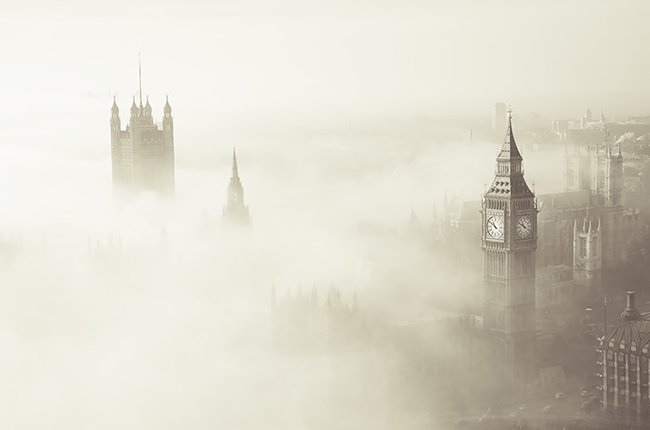
Natural Heritage: Researchers solve mystery of historic 1952 London fog and current Chinese haze
Natural Heritage: More infectious diseases emerging because of climate change

Environment: Warming opens famed Northwest Passage to navigation

Natural Heritage: Epoch-defining study pinpoints when humans came to dominate planet Earth
Natural Heritage: Coastal erosion study could hold valuable lessons for climate change mitigation

Uganda: Conservationists 'on the fence' about barriers to protect wildlife in drylands

Environment: World's largest canyon may lie under the Antarctic ice sheet

Environment: Scientists predict extensive ice loss from huge Antarctic glacier

Environment: Arctic sea ice hits record low
