The Great London [Search results for infrastructure]
Modern Housing Complex in London

UK: More than one in ten UK species threatened with extinction

The 1st Cable Car in London

Environment: Kew report urges global scientific community to secure health of the planet

Israel: Oldest glass production kilns found in Israel

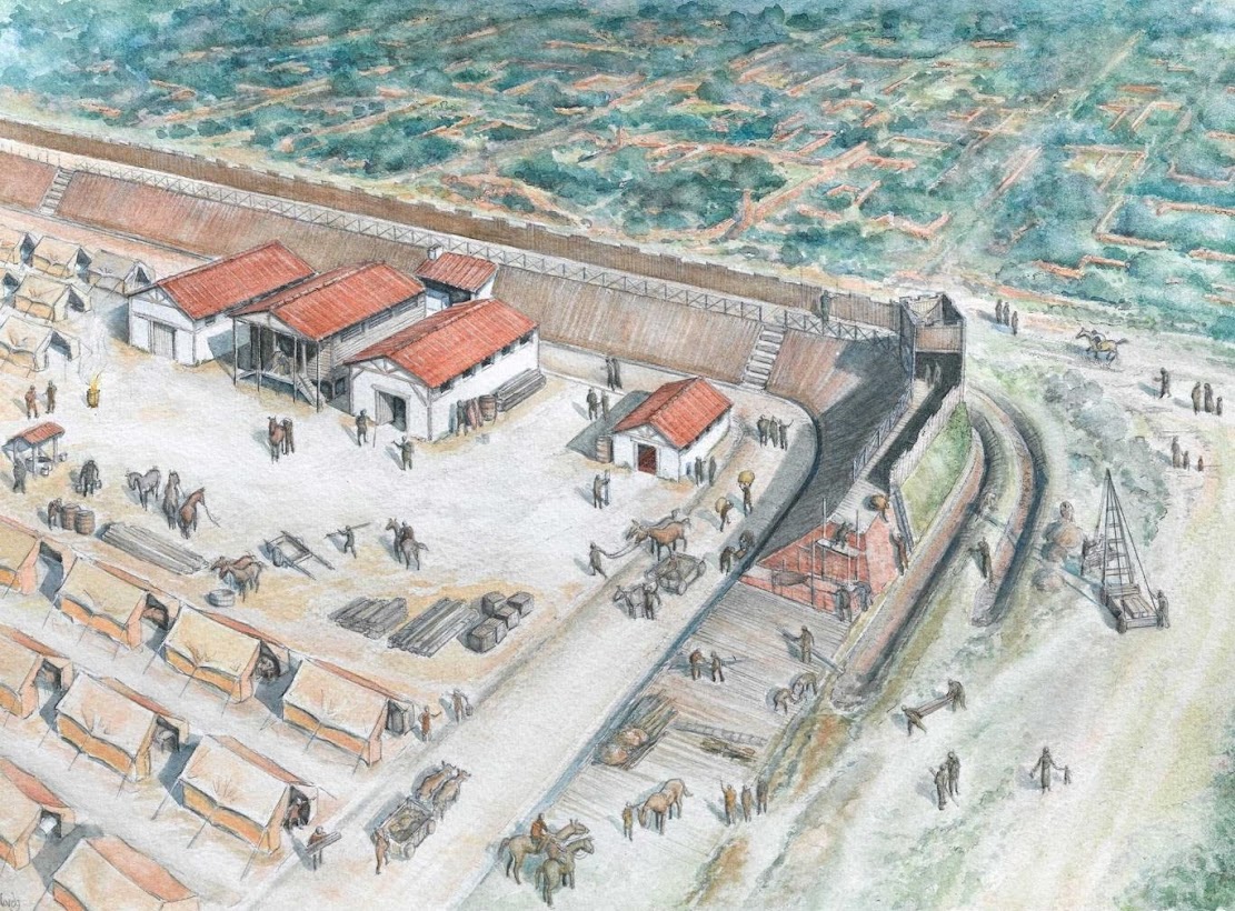
UK: Roman fort built in response to Boudicca’s revolt discovered in London
Natural Heritage: Epoch-defining study pinpoints when humans came to dominate planet Earth
Natural Heritage: Coastal erosion study could hold valuable lessons for climate change mitigation

Geology: Common magnetic mineral is reliable witness to Earth's history
